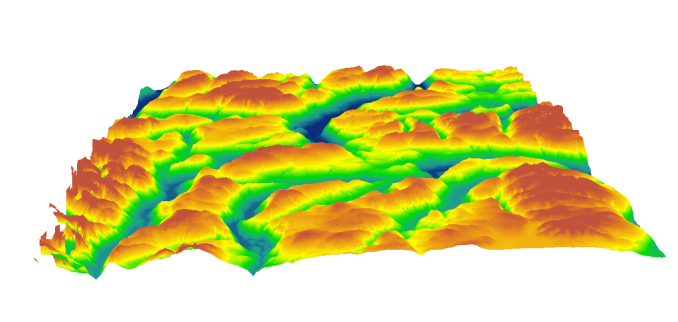
The quality of digital elevation models
The high digital qualities are attributed to its ability to adapt to the natural terrain. In fact, the greater the adaptation, the better the digital model. Often the quality of digital models is measured by measuring the accuracy of the elevation and its flatness, while other parameters such as the degree of timing also play a major role in the quality of the digital elevation models.
There are three categories of errors to consider in a DTM:
Random errors
Systematic errors
Big mistakes) mistakes)
Each of these errors could be due to one of the following: Shi et. AL, 2014))
Errors in the primary data from which the DEM originated.
Errors related to the devices from which this data was collected.
Human errors that occur during the process of obtaining primary data.
Errors arising from the models used in the various stages of processing performed on the primary data to convert them to DEM
Random Errors
These errors are due to the observational error of a single quantity that does not follow any specific law and follows the normal distribution. Low pass filters are often used to reduce their impact
Systematic errors
These errors often follow a specific pattern and are due to the lack of adjustment of the measuring instruments or the climatic and climatic conditions of the measurements. To eliminate the effects of these errors, most error patterns are identified and completely eliminated using specific mathematical models. Since a wide range of tools and methods can be employed in gathering the information needed to prepare a DEM, it is important to have a thorough knowledge of the methods and tools used in the process of preparing it.
Big mistakes (mistakes)
These errors, which occur in small quantities, are often caused by human error in the measurement or recording of information and can be identified and resolved by computational algorithms. Numerous methods for error detection have been presented so far, one of the most effective being proposed by Li (1990) based on the definition of a threshold for slope variations at each point. Li et.AL, 2004))
Read more in Leidar Data Processing Book
Authors Saeid Joyzadeh, Manijeh Brahimi, Mojgan Sadeghat
Phone Book Order: 09382252774 - 07132341477
Digital Elevation Model Quality, DEM Quality, DEM Accuracy, DEM Model, Digital Elevation Model, Digital Surface Model, Model, DTM Ground Digital Model,, Digital Terrain Model Surface Digital Model, Digital Elevation Model, DEM, DTM , DSM, DSM and DTM production of data, lidar DSM and DTM production of lidar data, DSM and DTM production of lidar data, height modeling training, DSM, DEM, DTM, production, DEM production DTM, digital production elevation model production, digital surface model production, digital terrain model 3D training in arcgis, 3D training in GIS, 3D training, gis, 3D DEM display training in ArcGIS, 3D DEM display, DEM application, DTM application, DSM application DEM free download sites,

 Dr. Saeed Javizadeh is the Director of the Third Millennium Scientific- Research Institute and loves the Geographical Sciences. He believes that the main enemies of humanity are fear, doubt and aimlessness. Bachelor of Natural Geography from Yazd University in 2002, MA of Natural Geography from Kharazmi University in 2005 and her Ph.D. in 2018 from Kharazmi University. The title of his thesis is "Spatial Analysis of Drought in Iran". He specializes in Geographic Information Systems (GIS) and Remote Sensing (RS) and Spatial Statistics. Since 2002 he has been teaching in public and private universities and centers. He holds specialized workshops for GIS and RS enthusiasts each year. He has written useful and practical books on geographic information systems and remote sensing and spatial statistics. He is currently working on advanced drones and programming in GIS and Remote Sensing. In addition, Saeed Javizadeh is interested in drought studies and natural disasters and has authored numerous books on drought. Dr. Javizadeh's wishes for an epidemic of GIS and spatial statistics between the people and the decision-making body